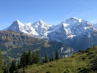
Eiger, Mönch and Lobhornhütte


- 3:50 h
- 9.47 km
- 700 m
- 670 m
- 1,486 m
- 1,958 m
- 472 m
- Start: Grütschalp
- Destination: Sulwald
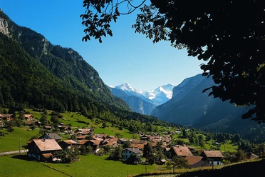
Many beautiful hiking trails lead to the Lobhornhütte. And the trio Eiger, Mönch, and Jungfrau is always within reach. Those who prefer a moderate hike a little off the beaten tourist paths can start from Grütschalp. From there, the route goes on beautiful mountain paths and mostly through forest into the Soustal. At the Alp Sousläger, the trail crosses the valley side and first leads steeply uphill, then over mountain pastures to Alp Suls and the idyllic Sulsseewli. Now it is just a stone's throw to the Lobhornhütte, which offers food and drink on a splendid viewing terrace in a wild karst area. Refreshed, the descent goes down to Sulwald, where you can board the small, almost nostalgic cable car to Isenfluh.
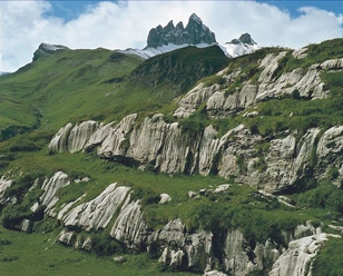
The hike high above the Lauterbrunnen valley offers, besides a charming panorama, further mountain experiences. Alp Suls and the Sulsseewli lake lying in a hollow are so beautiful that according to legend they are inhabited by a landscape goddess and nature spirits. The fact is that the mountain lake shimmers in various colors depending on the weather and has no surface outflow. Those who lift their gaze from the lake see in the distance the five rocky peaks of the Lobhörner. When looking up to the weathered mountain flank of the Ars on the ascent to Suls, you will discover an upside-down heart. Here you get an idea of the tremendous forces that must have acted during the folding of the mountain range. On the descent to Sulwald, a short detour to Chüebodmi is worthwhile, where a huge boulder lies. According to legend, the indigenous people are said to have met here for the spring festival.
The region is also suitable for family hikes. From Sulwald, you can get to the Lobhornhütte at a leisurely pace in two hours. There is also an exciting themed trail – and a "monster trotti descent" from Sulwald to Isenfluh.
Author: Godi Huber

Good to know
Pavements
Best to visit
Directions
Equipment
Directions & Parking facilities
Outbound: From Lauterbrunnen by cable car to Grütschalp mountain station
Return: Sulwald – Isenfluh by cable car; Isenfluh – Lauterbrunnen by post bus
Additional information
Berner Wanderwege, 031 340 01 01, info@beww.ch, bernerwanderwege.ch
License (master data)
Safety guidelines
Map
Nearby