Winter trail Niederhorn - Waldegg


- 3:15 h
- 9.77 km
- 60 m
- 810 m
- 1,202 m
- 1,951 m
- 749 m
- Start: Beatenberg, Niederhorn
- Destination: Beatenberg, Waldegg
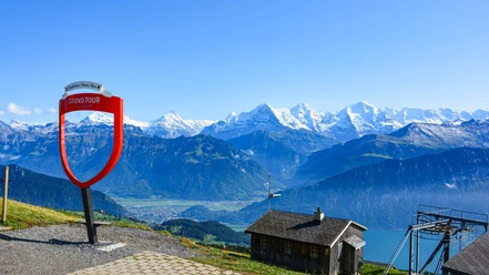
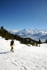
From the traditional tourist resort Beatenberg, a gondola takes you to the Niederhorn. The summit is just a few steps above the mountain station. From here, an overwhelming panoramic view opens up: to the east, the chain of the Brienzer Rothorn, next to it the Bernese High Alps with the proud trio Eiger, Mönch and Jungfrau, followed by the countless peaks of Kander, Engstligen and Simmental, further a magnificent view down to the Thun agglomeration and behind it the federal capital, as well as, on the northwestern horizon, the Jura chain with the Chasseral as the most distinctive reference point. To the north lies the Justistal at your feet, which on the other side is bordered by the Sigriswiler Rothorn chain.
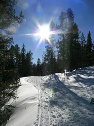
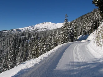
From the Niederhorn, the route runs below the Güggisgrat initially straight ahead, then in sometimes quite steep descent first to Oberburgfeld. The path is wide, prepared with piste vehicles, thus offering sledders and hikers enough space. Through open terrain it goes further downhill to Unterburgfeld. Here the route turns into a flat forest path passing through loose pine and spruce stands. Again and again, this extremely attractive section offers views of the mountain world of the Jungfrau region.
From Chüematte it goes downhill again through open terrain. The path leads above the Hohwald ski lift and east of the slopes over the Waldeggallmi swiftly into the settlement area of Beatenberg/Waldegg and down to the postal bus station as the destination point.

Good to know
Pavements
Best to visit
Directions
Equipment
Directions & Parking facilities
Arrival: By postal bus from Interlaken to Beatenberg station or from Thun via STI bus to Beatenbucht and then by funicular to Beatenberg station. From there, take the gondola to the Niederhorn.
Return: By postal bus from Beatenberg Waldegg to Interlaken West.
Additional information
Literature
Hiking suggestion from the hiking book Schneepfade im Berner Oberland, hiking book series of the Bernese Hiking Trails
License (master data)
Safety guidelines
Map
Nearby


")
")
")