Wetterhorn Trail 2 - Grindelwald (signposted)


- 2:00 h
- 3.48 km
- 240 m
- 240 m
- 1,229 m
- 1,436 m
- 207 m
- Start: Grindelwald/Oberer Gletscher
- Destination: Grindelwald/Oberer Gletscher
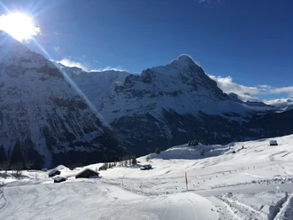
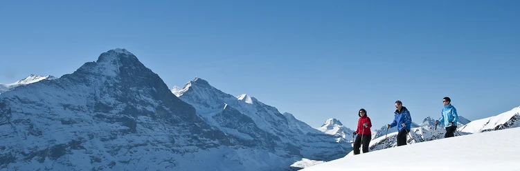
Although this route does not lead to a summit, it does not lack impressive views. The Wetterhorn and the Chrinnenhorn are within reach, the view extends to the Upper Grindelwald Glacier, which has retreated significantly. The Eiger, Grindelwald-First, as well as the Great and Small Scheidegg, are also in sight. It is also worth occasionally taking your eyes off the mountains. At the start, you can admire a replica of a cabin from the former Wetterhorn lift. As the first public aerial cableway in Switzerland, the lift was supposed to lead over four sections to the summit of the 3692-meter Wetterhorn! However, only the first section up to the Enge mountain station was built from 1905 to 1908, which is still visible today. Even this pioneering effort was not worthwhile. Operation had to be stopped in 1915 after the outbreak of the First World War and could never be resumed.
In Ischboden, there is also the Alpenvogelpark Grindelwald. Various, mostly native bird species are kept and cared for in aviaries. Alpine birds such as the capercaillie, the snowy owl, or the rock ptarmigan can be admired here.
Godi Huber

Good to know
Pavements
Best to visit
Directions
Oberer Gletscher - Ischboden - Unders Loichbiel - Schürli - Oberer Gletscher
Equipment
We recommend the following equipment: sturdy and waterproof hiking boots, light to medium backpack, cold protection, sun protection, hiking poles, pocket pharmacy, snacks, tea in a thermos, mobile phone.
Directions & Parking facilities
Additional information
Bern Hiking Association, Bern, Tel.: 031 340 01 01, Email: info@beww.ch, Homepage: www.bernerwanderwege.ch
License (master data)
Safety guidelines
This route is signposted as a snowshoe route but not specially prepared.
Map
Swisstopo national map 1229 Grindelwald 1:25,000
Nearby
Download GPX file