Under the spell of Eiger, Mönch and Jungfrau

- 3:50 h
- 11.21 km
- 20 m
- 1,130 m
- 1,276 m
- 2,224 m
- 948 m
- Start: Männlichen
- Destination: Wengen
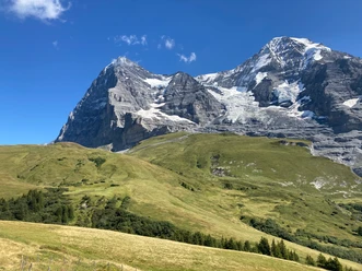
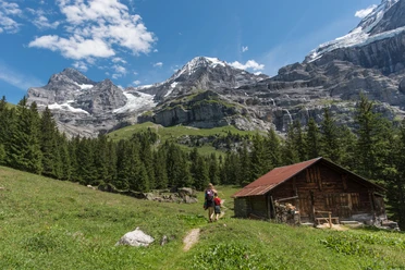
The view to the nearby high alpine peaks and across the Jungfrau hiking area is a delight. Without special effort, you reach Kleine Scheidegg via Honegg. The well-developed hiking trail offers the most interesting views of the infamous Eiger North Face (to Lauberhorn 1h15; to Eigergletscher station 50 min and via Wixi to Wengernalp 2h). Near the railway track you pass a small mountain pond to Wengernalp station (via Biglenalp–Stalden to Wengen 2h30). On the opposite mountain flank, ice avalanches thunder down, while the summit of Silberhorn shines in pure beauty. First gently, then more steeply descending you pass the stations Baawald and Allmend to the upper houses of Wengen, through alleys and back to Wengen station.

Good to know
Pavements
- Asphalt (14%)Trail (80%)Gravel (6%)
Best to visit
- suitableDepends on weather
Directions
- Männlichen - Kleine Scheidegg - Wengernalp - Wengen
Equipment
- We recommend the following equipment: sturdy mountain boots, medium-sized backpack with hip belt, sun protection, rainwear, hiking sticks, pocket pharmacy, picnic, sufficient fluids, mobile phone.
Directions & Parking facilities
- Getting thereBy car via Wilderswil to Lauterbrunnen. Then by train and cable car to Männlichen.Public transportation
Outbound trip: By train via Interlaken Ost to Grindelwald. From there by cable car to Männlichen.
Return trip: From Wengen by train to Lauterbrunnen and Interlaken Ost
Additional information
- Bern Hiking Association, Bern, Tel.: 031 340 01 01, Email: info@beww.ch, Homepage: www.bernerwanderwege.ch
Literature
Hiking suggestion from the Berner Oberland hiking book, hiking book series of the Berner Wanderwege
License (master data)
Safety guidelines
This route runs entirely or partially on marked paths in the mountain trail category.
Map
- Swisstopo hiking map 1:50,000 254T Interlaken
Nearby

Download GPX file