To ancient churches on Lake Thun


- 3:00 h
- 11.11 km
- 270 m
- 270 m
- 558 m
- 662 m
- 104 m
- Start: Thun/Dürrenast
- Destination: Spiez
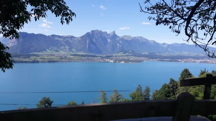
From the Strandbad bus stop in Dürrenast, pass under the main road to the nearby lake shore. The beautifully constructed lakeside path follows the reed belt, sometimes also on wooden walkways over quiet bays. From Bonstettenpark (benches, playground) with its gnarled old trees, enjoy the magnificent view over the lake to Eiger, Mönch, and Jungfrau. In Gwatt, cross the main road and then turn steeply away from the lake up to Gwattegg. The view from the large lime tree on the nearby Strättli hill is magnificent across the lower Thunersee basin, the city of Thun, the Glütschbach valley (the original course of the Kander), and the rocky peak of the Stockhorn.
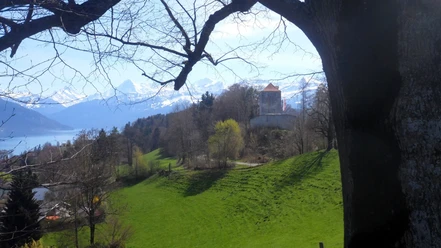
Descend gently past the somewhat hidden Strättligturm, where the nobles of Strättligen once lived. Beyond the Simmental road, you suddenly stand before the dark chasm of the Kander breakthrough. In 1713, the Kander was to be forced into the Thunersee for debris deposition. Already a year later, the wild river tore open the blasted tunnel. On the sturdy Strättlig bridge to the opposite riverbank and up to Einigen. A small road now leads over a scenic ridge to Riederen. Afterwards, the Rustwald is crossed on forest roads and narrow paths. In Spiezmoos, pass under the railway line and the main road and climb up to the wooded Spiezberg. At the forest edge, enjoy another magnificent view over the vineyards to the castle and castle church of Spiez. Through the castle grounds, the route goes down a flight of stairs to the Ländte in Spiez Bay.

Good to know
Pavements
Best to visit
Directions
Thun - Gwatt - Einigen - Spiezberg - Spiez
Equipment
We recommend the following equipment: light trekking shoes, light backpack, sun protection, rain jacket, pocket pharmacy, light picnic, sufficient fluids, mobile phone.
Additional information
Association Bernese Hiking Trails, Bern, Tel.: 031 340 01 01, E-Mail: info@beww.ch, Homepage: www.bernerwanderwege.ch
Literature
Hiking suggestion from the hiking book Thunersee - Frutigland, hiking book series of the Bernese hiking trails
License (master data)
Author´s Tip / Recommendation of the author
Safety guidelines
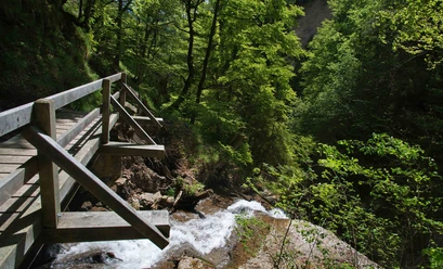
This route runs entirely on hiking paths.
Map
Swisstopo hiking map 1:50,000 253T Gantrisch
Nearby