Panoramic hike over the Honegg


- 4:40 h
- 14.47 km
- 720 m
- 600 m
- 912 m
- 1,510 m
- 598 m
- Start: Schwarzenegg
- Destination: Innereriz
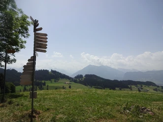
From the Schwarzenegg bus stop, you hike to the cemetery and further across a wide plateau. First you walk along the forest edge, then steeply up a rough forest path to the Chürzi farm. In the mid-19th century, this path was the only connection from Schwarzenegg to Eriz. Particularly beautiful here is the Hintere Kapfern farm, with views of the cliff faces of Hohgant, Solflue, and Sigriswilgrat. Looking back, the panorama opens up on the peaks and ridge of Gurnigel, Längenberg, and Guggershörnli. Always following the ridge line, you reach the Chnubelhütte, with an impressive view. Past Honegg, the rather steep descent starts above Honeggli through the raised bog plain Rotmoos into Innereriz.

Good to know
Pavements
Best to visit
Directions
Schwarzenegg – Chnubelegg – Honegg – Rotmoos – Innereriz
Equipment
We recommend the following equipment: light trekking shoes, light backpack, sun protection, rain jacket, pocket pharmacy, light picnic, sufficient fluids, mobile phone.
Directions & Parking facilities
Starting point: Schwarzenegg, village From Bern, various connections to Thun. From Thun station, take bus number 41 towards Eriz, Säge, to Schwarzenegg, village.
Destination: Eriz, Säge From Eriz, Säge, take bus number 41 towards Thun station, to the final stop. From Thun, various connections to Bern.
Additional information
Berner Wanderwege, 031 340 01 01, info@beww.ch, bernerwanderwege.ch
Literature
Hiking suggestion from the hiking book Emmental - Oberaargau, hiking book series of the Berner Wanderwege
License (master data)
Author´s Tip / Recommendation of the author
More similar offers in the region can be found at: https://www.stibus.ch/ausflugsziele
Safety guidelines
This route runs exclusively on signposted paths of the category hiking trail
Map
Swisstopo hiking map 1:50,000 244T Escholzmatt
Nearby

