Mighty glacier traces in Grindelwald


- 2:25 h
- 6.23 km
- 350 m
- 580 m
- 1,014 m
- 1,398 m
- 384 m
- Start: Grindelwald / Upper Glacier
- Destination: Glacier Gorge
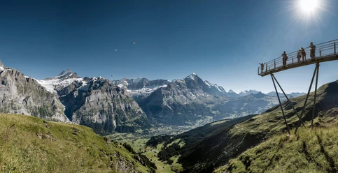
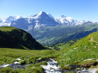
In the 19th century, Grindelwald gained international fame. On both sides of the Mättenberg, mighty glaciers reached close to the settlement area. The tongue of the Upper Grindelwald Glacier ended at around 1200 m, that of the Lower Grindelwald Glacier even only at 1000 m. Nowhere else in the world could the impressive force of eternal ice be experienced closer and more intensely than here in the glacier village, as the place was soon called. Already in earlier centuries, the two glaciers did not always have such enormous dimensions. Since the Middle Ages, they retreated strongly several times, only to advance again into the valley with even greater intensity. During the 20th century, they began to melt again – initially slowly, since the 1990s with rapidly increasing intensity. Their retreat drastically changed the landscape's appearance: where once ice masses had piled up, now bare rock slabs and moraines are visible. From the bus stop at Hotel Wetterhorn, a gravel road and later a forest path lead up to Chalet Milchbach. The inn once stood right next to the glacier; today it stands alone in the forest. A narrow, yet well-developed trail follows the flank of the Mättenberg and leads through romantically wild block debris, over flower-rich alpine meadows, and through shady mountain forest. A rockfall-prone zone is crossed by a tunnel built especially for hikers. After another short ascent, you reach Pfingstegg, from where you enjoy a beautiful view of the entire Grindelwald valley and the rugged rock towers on the eastern slope of the Eiger. You are already approaching the notch that the Lower Grindelwald Glacier has created. At Wyssefluh, you leave the high path and quickly descend to the marble quarry, where marble blocks were mined until the early 20th century. A short section of asphalt road leads to the Glacier Gorge, which is crossed on a spectacularly designed bridge. Then it goes steeply downhill again to the Glacier Gorge bus stop.

Good to know
Pavements
Best to visit
Directions
Grindelwald/Hotel Wetterhorn - Pfingstegg - Glacier Gorge
Equipment
We recommend the following equipment: sturdy mountain boots, medium-sized backpack with hip belt, sun protection, rainwear, hiking poles, first aid kit, picnic, sufficient fluids, mobile phone.
Directions & Parking facilities
Outbound journey: by train via Interlaken Ost to Grindelwald. From there by bus towards Grosse Scheidegg to Upper Glacier.
Return journey: by bus from Glacier Gorge to Grindelwald.
Additional information
Berner Wanderwege, T 031 340 01 01, info@beww.ch, bernerwanderwege.ch
Literature
Hiking suggestion from the short hikes guidebook, hiking guidebook series of Berner Wanderwege
License (master data)
Safety guidelines
This route runs entirely or partly on marked paths of the mountain trail category
Map
Swisstopo hiking map 1:50,000 254T Interlaken
Nearby