- 6:10 h
- 16.59 km
- 1,200 m
- 1,200 m
- 1,947 m
- 2,708 m
- 761 m
- Start: Grindelwald/First
- Destination: Grindelwald/First
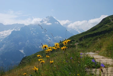
From the top station of the First cable car, follow the well-trodden path towards Faulhorn (also accessible in winter!). Already after a few steps, an attractive variant presents itself (–Bachläger–Bachalpsee–Pt. 2278, 1h20), which together with the main route section forms a very impressive, short circular hike. At every step, the panorama of the Grindelwald mountains widens, even the Blüemlisalp is visible to the west. Before reaching the Bachaipsees, at Pt. 2278, leave the wide Faulhorn path to the right (towards Bachalpsee–Gassenboden–Faulhorn 1h20) and ascend past a small lake below the rocky flank of the Ritzengrätlis. At the Egg turn towards the saddle at Tierwang (to Faulhorn 1h).
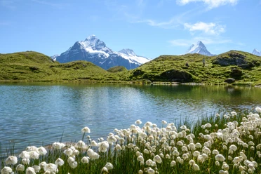
The silence of the mountain world becomes increasingly impressive on the descent to Hagelseewli. At the often partly frozen mountain lake still frequently frozen even into late midsummer, one reaches the Hiendertelli (Hühnertälchen) via another saddle. Striking is the pronounced contrast between sunny and shady sides: on the left a green hillside, on the right a continuous scree slope dominated by the rocks of Widderfeldgrätlis. In the hollow of Häxeseelis the bare rock surfaces increase, greenery becomes scarce, yet numerous scree and cliff plants persist. The path disappears.
Only the white-red-white mountain trail marker indicates the way through a primeval karst landscape. Maintaining direction, one reaches the Wart signpost over a moraine wall at the saddle between Wildgärst and Schwarzhorn (the detour to the rewarding viewpoint Wildgärst is highly recommended! 30 min).
The very steep descent leads along the Blaugletscher, a firn snowfield, passing the distinctive Schrybershörnli to Oberläger on the Scheidegg. Wonderful is the view through the Rosenlaui valley to the Titlis, to the Fünffingerstöcke at the Susten Pass, and to the nearby jagged row of Engelhörner. At Gratschärem (towards Grosse Scheidegg 20 min), turn right, choose the upper path (or the slightly lower road) and gently ascend through blueberry, heather, and dwarf juniper stands before reaching the Alphüttendörfli of Grindel/Oberläger and then returning to the First.

Pavements
- Trail (39%)Path (50%)Gravel (11%)
Best to visit
- suitableDepends on weather
Directions
- Grindelwald/First - Hagelseewli - Wart - Scheidegg/Oberläger - Grindelwald/First
Equipment
- We recommend the following equipment: sturdy mountain boots, medium-sized backpack with hip belt, sun protection, rain gear, hiking poles, pocket first aid kit, picnic, sufficient liquids.
Additional information
- Association Berner Wanderwege, Bern, Tel.: 031 340 01 01, Email: info@beww.ch, Homepage: www.bernerwanderwege.ch
Literature
- Hiking suggestion from the Bernese Oberland hiking book series of BWW, order at: http://shop.bernerwanderwege.ch
License (master data)
Safety guidelines
- This route runs entirely or partially on mountain hiking trails.
Map
- Swisstopo Hiking Map 1:50,000 254T Interlaken