

- 1:02 h
- 2.78 km
- 154 m
- 154 m
- 1,293 m
- 1,443 m
- 150 m
- Start: Interlaken Harder Kulm, Harderbahn mountain station
- Destination: Interlaken Harder Kulm, Harderbahn mountain station
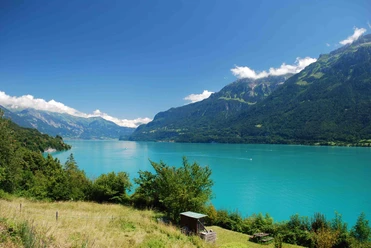
The broad panoramic trail leads through pleasantly shaded mountain forest and offers a comprehensive view of Lake Brienz and Lake Thun, the Bödeli between the two lakes, as well as the majestic summit group of Eiger, Mönch, and Jungfrau.
From the Harder Kulm restaurant, the path initially runs as a stony but fairly wide and leisurely mountain trail. Then you might even break a sweat when overcoming the considerable climb to the Hardergrat. Afterwards, a comfortable descent awaits on a narrow path through the idyllic Wanniwald back to Harder Kulm. The hike offers a pleasantly easy route profile. We recommend good hiking boots with grippy soles to safely enjoy this unique mountain trail.

Pavements
- Trail (18%)Path (82%)
Best to visit
- suitableDepends on weather
Directions
Harder Kulm - Hardergrat - Wanniwald - Elfenweg - Harder Kulm
Equipment
Normal hiking equipment, hiking boots with grippy soles.
Directions & Parking facilities
- Getting there
Via Bern or Lucerne to Interlaken. From the south via Grimsel Pass (only in summer) or via Simplon Pass and Lötschberg car transport to Interlaken.
ParkingOpen-air parking directly next to Interlaken Ost station.
Public transportationShort walk from Interlaken Ost station to the valley station of the Harderbahn. Take the modern funicular to Harder Kulm. Travel time from the valley station: 10 minutes.
Additional information
Hike 76
(in the printed summer panoramic map of the Jungfrau Railways)
License (master data)
Author´s Tip / Recommendation of the author
Suitable for hot summer days.
Safety guidelines
Mountain hiking trail with some slightly exposed sections.