Circular hike Aenderberg bridge


- 1:20 h
- 5.34 km
- 10 m
- 10 m
- 565 m
- 584 m
- 19 m
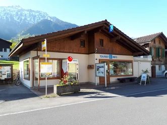
- Start: Bönigen See, Bönigen Tourism Office
- Destination: Bönigen See, Bönigen Tourism Office
Walk from the Bönigen tourism office along the lake promenade and cross the footbridge over the Lütschine. Then follow the river to the main road. Continue along the Lütschinendamm to the Aenderberg bridge, always accompanied by the sound of the water. Cross this impressive covered wooden bridge and hike towards Acherhubel. Soon you will discover the "Chrottengrääbli", a renaturalized small stream that provides a home for many animals. Passing the Acherhubel farm with its farm shop, walk back towards the church and back to Bönigen.

Good to know
Best to visit
Directions
Bönigen See – Lütschine – Aenderberg bridge – Acherhubel – Bönigen See
Directions & Parking facilities
From Bern/Thun: Leave the A8 motorway at the Interlaken Ost / Bönigen exit, then follow the signs to Bönigen.
From Brienz: Leave the A8 motorway at the Bönigen exit, then follow Oberlandstrasse.
Additional information
Seestrasse 6
3806 Bönigen
Tel.: +41 33 822 29 58
mail@boenigen-iseltwald.ch
www.boenigen-iseltwald.ch
Interlaken Tourism
Marktgasse 1
3800 Interlaken
License (master data)

Author´s Tip / Recommendation of the author
Visit the farm shop at Acherhubel (observe opening hours)
Nearby


")
Download GPX file