- 5:40 h
- 42.55 km
- 1,372 m
- 1,372 m
- 860 m
- 1,603 m
- 743 m
- Start: Habkern, Post bus stop
- Destination: Habkern, Post bus stop
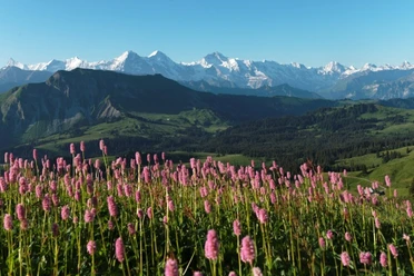
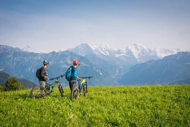
The route is characterized by a magnificent mountain backdrop, unique nature, lush meadows, and green forests. After starting in Habkern, the road leads over partly steep paved and gravel roads towards Grünenbergpass. Then it goes over a beautiful, bumpy descent into the valley with a view of the Hohgant. On your way towards Kemmeriboden-Bad you pass through idyllic landscapes. By the way, the famous Kemmeriboden-Bad meringues are always worth a short break. After the refreshment, it goes very steeply up the packhorse trail into the final ascent to Harzisboden. Once at the top, a magnificent landscape awaits you. It continues through moor areas to the highest point of Lombachalp. Take another short break before you briskly tackle the paved road back to Habkern to the starting point, accompanied by a beautiful view of mountains and Lake Thun.
On this demanding route, the bike must be pushed in places.

Pavements
- Street (78%)Trail (22%)
Best to visit
- suitableDepends on weather
Directions
- Habkern – Grünenbergpass - Bumbach – Kemmeriboden-Bad – Harzisboden – Lombachalp - Habkern
Directions & Parking facilities
- Getting thereArrival by public transport or PostBus guaranteed
Additional information
- The information on duration, condition, and technique depends on the chosen bike type (mountain bike, e-bike, e-mountain bike, touring bike, road bike). These are average guidelines.
Interlaken Tourism
Marktgasse 1
CH-3800 Interlaken
Phone: +41 33 826 53 00www.interlaken.swiss/hiking
Tourism Office
Im Holz
CH-3804 Habkern
0041 33 843 82 10
info@habkern.ch
www.habkern.ch License (master data)

Author´s Tip / Recommendation of the author
- There is a push section at Harzisbode. The route should be ridden in the suggested direction, otherwise a long push section to Grünenbergpass must be overcome. For e-bikes, the route is more difficult to ride due to the partly steep terrain (including stones, scree) and the mentioned push section.