With the view of Ferdinand Hodler

- 4:00 h
- 13.96 km
- 292 m
- 400 m
- 557 m
- 700 m
- 143 m
- Start: Spiez
- Destination: Därligen
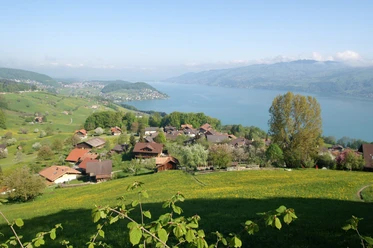
From Spiez station you reach the Spiez Bay at the beach through a neighborhood street and a path with steps. The hike along the lakeshore path to Faulensee through magnificent tree population is incomparably beautiful. Slightly above the wind-protected bay stands the church built in 1960 on a gentle hill, during construction the remains of a castle and the former Columban chapel were found. Along the lake it goes to Güetital, where the path turns quite steeply uphill into the slope of the rain and leads to the viewing terrace of Krattigen. From here, the view extends across the whole lake.
A small road now follows the Chrattighalte and merges at point 640, near the quarry belonging to the Leissigen gypsum factory, into the road. Yet, it is possible to avoid it again and reach the lakeshore path to Leissigen via a low-traffic small road. The church is counted among the “12 Lake Thun churches”. However, its current form dates back to 1675.
Slightly outside the village, in Buechholz, the path branches off to the Hodler memorial on the Finel (detour 20 min, magnificent viewpoint). A small road winds gently up and down through forests and over meadows to Egghubel and down to Därligen.

Good to know
Pavements
Best to visit
Directions
Spiez - Krattigen - Leissigen - Därligen - Interlaken
Equipment
We recommend the following equipment: light trekking shoes, light backpack, sun protection, rain jacket, pocket pharmacy, light picnic, sufficient fluids, mobile phone.
Directions & Parking facilities
Outbound journey: by train to Spiez
Return journey: by bus from Därligen to Interlaken West or Spiez
Additional information
Bernese Hiking Trails Association, Bern, Tel.: 031 340 01 01, E-mail: info@beww.ch, Homepage: www.bernerwanderwege.ch
Literature
Hiking suggestion from the hiking book Thunersee - Frutigland, hiking book series of the Bernese Hiking Trails
License (master data)
Safety guidelines
This route runs entirely on hiking trails.
Map
Swisstopo hiking map 1:50,000 254T Interlaken
Nearby