Winter hiking trail Beatenberg/Waldegg - Habkern

- 2:45 h
- 7.91 km
- 230 m
- 360 m
- 1,054 m
- 1,409 m
- 355 m
- Start: Beatenberg, Waldegg
- Destination: Habkern
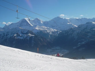
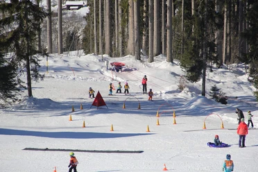
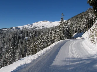
From the post bus stop Beatenberg/Waldegg, first ascend on the road toward Habkern, after 100 m turn off and continue uphill along the forest edge toward Amisbüel. The route is intermittently marked with natural wood signs. On a gentle ascent, pass sun-drenched chalets and barns along the slope. Higher up, snowboarders and skiers make their turns, and countless families enjoy exhilarating sled rides. The mountain scenery, dominated by the harmonious ensemble of Eiger, Mönch, and Jungfrau, is wonderful.
The prepared winter hiking trail follows the ski trail into the forest; at point 1408, it turns right and continues with a pleasant descent. Gaps in the tree cover allow adventurous deep views into the Lombach valley. In the Holzflüe area, pastureland replaces the forest. The view sweeps freely over the noticeably different panorama. To the east, the steep, forested back of the Harder is visible. This mountain ridge is the western end of the Augstmatthorn range. Its most prominent features are the Suggiture and the Augstmatthorn. Their snow-covered northern slopes gleam enticingly in the winter sun—a tempting lure for countless ski tourers. To the north, the panorama ends with the unusually gentle-looking Hohgant from this perspective.
At the Büelbach, which here forms the boundary between the municipalities of Beatenberg and Habkern, the path swings southeast and leads on a small road to the Büelbach location. The scattered settlement of Habkern, with its small church as a visual attraction, now comes into view. A quiet peace lies over the wintry rural scene. On a small road, descend to Bort, from there continue along the slope on an almost level path to the village center of Habkern. A short visit to the charming church is highly recommended. The ornate organ dates from the Biedermeier period, six coats of arms date from the 17th century. Only a few steps remain to the end point of the hike, the post bus stop Habkern/Post. Among several stately farmhouses, the beautifully carved guesthouse Bären, built in 1793, is especially impressive.

Good to know
Pavements
Best to visit
Directions
Beatenberg/Waldegg - Büelbach - Bort - Habkern
Equipment
We recommend the following equipment: sturdy and waterproof mountain boots, light to medium backpack, cold protection, sun protection, hiking poles, pocket first aid kit, snacks, tea in a thermos bottle.
Directions & Parking facilities
Additional information
Bernese Hiking Trails Association, Bern, Tel.: 031 340 01 01, E-mail: info@beww.ch, Homepage: www.bernerwanderwege.ch
Literature
Hiking suggestion from the hiking book Schneepfade in the Bernese Oberland, hiking book series by the BWW
License (master data)
Safety guidelines
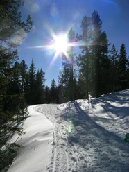
This route runs on groomed winter hiking trails.
Map
Swisstopo national map 1208 Beatenberg 1:25,000
Nearby


")
")
