The Kander Cut-through


- 2:45 h
- 10.26 km
- 150 m
- 140 m
- 558 m
- 654 m
- 96 m
- Start: Thun Gwatt
- Destination: Thun Allmendingen
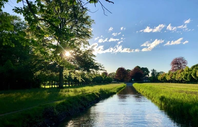
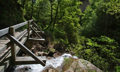
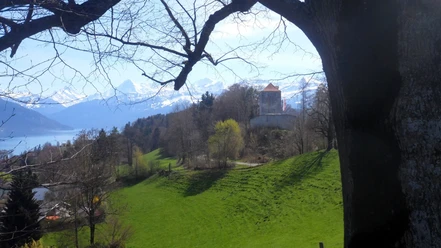
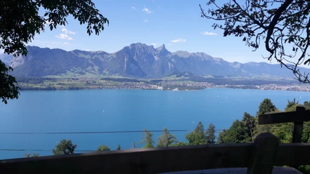
The hike leads along the lakeshore of Lake Thun through Bonstetten Park. Through the village of Gwatt, you hike steeply uphill until you reach the Burgunderweg. Here, there is a wonderful view of the Eiger, Mönch, and Jungfrau, over Lake Thun and as far as Thun. The narrow path is adorned on both sides by willows and mighty, old chestnut trees. On the ridge, the impressive powder tower, the "Strättligburg," soon appears. A little downhill, you soon reach the road and cross it. Then it goes steeply downhill for a short distance on steps. The Kander carves its way deep below through the gorge. From the Strättlig footbridge, you look deep down.

Good to know
Pavements
Best to visit
Directions
Thun Gwatt–Strättlighügel–Kander–Glütschbachtal–Thun Allmendingen
Equipment
We recommend the following equipment: lightweight trekking shoes, light backpack, sun protection, rain jacket, pocket pharmacy, light picnic, enough fluids, mobile phone.
Directions & Parking facilities
Outbound journey: From Bern via Thun to Gwatt Camping
Return journey: From Bern via Allmendingen near Thun, Thun to Bern
Additional information
Berner Wanderwege, 031 340 01 01, info@beww.ch, bernerwanderwege.ch
License (master data)
Safety guidelines
This route runs exclusively on marked paths of the hiking trail category.
Map
Swisstopo hiking map 253T Gantrisch 1:50,000
Nearby


