Summit hike to the Rauflihorn


- 6:00 h
- 14.29 km
- 1,105 m
- 1,107 m
- 1,224 m
- 2,323 m
- 1,099 m
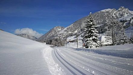
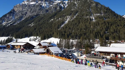
- Start: Senggiweid (Grimmialp), Schwenden
- Destination: Senggiweid (Grimmialp), Schwenden
At the beginning you walk along the adventure trail Grimmimutz through the home of the woodland character Grimmimutz. Although you cover many altitude meters in a relatively short time from Nidegg, every step through the shady mountain forest is worthwhile: Along the way you reach viewpoints with beautiful far views, reach a wild mountain stream waterfall, and discover the red, iron-rich mineral springs of the Grimmiwasser. As soon as you have reached the saddle of the Grimmifurggi, you look into the neighboring community of St. Stephan and into the Färmeltal. From here follows the last ascent to the summit. Would you have expected such a view? On one side the rocky massif of the Spillgerte, on the other side the openness and breadth of the Diemtigtal Nature Park.
Our recommended descent first takes you back the same way to Grimmifurggi and then back to the starting point via the GrimmiJutz and Grimmimutz paths.

Good to know
Pavements
Best to visit
Directions
Follow the route from Senggiweid over Würzi through the forest. The mountain path winds in many curves up to the Alp Grimmi and leads through the power place Grimmiwasser to the Grimmifurggi Pass. From here you can reach the summit of the Rauflihorn in just under an hour. To avoid crossing a pasture with livestock guardian dogs in the Nessli area, we recommend first returning the same way to Grimmifurggi, then heading towards the mountain station of the Grimmialp cable cars and then following the adventure trails GrimmiJutz and Grimmimutz down to the valley. The path is marked with yellow directional signs or waymarks as a mountain path.
Equipment
Good mountain boots, weather-appropriate clothing (sun/rain protection), possibly hiking poles, possibly binoculars, first aid kit, backpack with provisions and enough drinks for the way
Directions & Parking facilities
Motorway A6 Bern towards Zweisimmen, turn left 1 km after the Simmenfluhtunnel towards Diemtigtal. Follow the Diemtigtal road upstream for 19 km towards Schwenden, Grimmialp.
Paid parking spaces are located directly at the starting point.
By train to Oey-Diemtigen. Then by post bus to the stop "Schwenden i.D., Grimmialp" (end station). From here a short walk (approx. 5 min.) in the direction of Grimmimutzweg to Senggiweid, your starting point.
Additional information
Naturpark Diemtigtal
Bahnhofstrasse 20
3753 Oey
T 033 552 26 00
info@diemtigtal.ch
www.diemtigtal.ch
Did you enjoy this route?
We look forward to your review on > outdooractive
License (master data)
Author´s Tip / Recommendation of the author
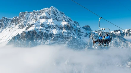
Those who want to shorten the ascent and descent of the hike can do so with the chairlift of the Grimmialp cable cars (observe opening hours: grimmialp.ch).
Nearby


Download GPX file