Over the wild Golitschepass

- 3:20 h
- 7.95 km
- 387 m
- 1,150 m
- 1,170 m
- 2,179 m
- 1,009 m
- Start: Elsigenalp
- Destination: Kandersteg
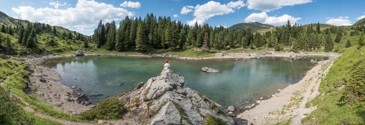
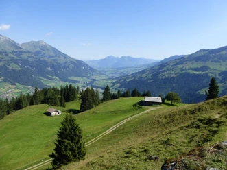
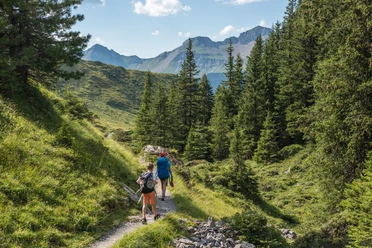
By prior arrangement with the Elsigenalp-Bahn, Tel. 033 671 33 33, a minibus runs from the Achseten bus stop to the Elsigbach valley station! The view into the expansive Elsigenalp, which offers a mountain peace with lush alpine meadows, larch groups, fields of alpine roses, and the deep blue Elsigsee, is surprising. Passing the mountain inn at Undere Elsige, you climb up to the huts at Obere Elsige. Now, sometimes without a path, it goes around the Stand ridge into the alpine basin at Golitschepass. Breathtaking is the view from the nearby Golitschehöri, which lies only 14 m higher. Peak after peak lines up all around. Between Niesen and Gehrihorn, the view extends out to Lake Thun and as far as the blue band of the Jura. Only faintly developed is the extremely steep pasture path, which zigzags down through scree fields and over alpine pastures to the hut on Alp Golitsche. Now the path turns right around a ditch, crosses it, and descends between cliff bands over pastures and through forest to the terrace Uf der Höh, from where you finally descend through the forest to Kandersteg station.

Good to know
Pavements
Best to visit
Directions
Elsigenalp - Golitschepass - Uf der Höh - Kandersteg
Equipment
We recommend the following equipment: sturdy mountain boots, medium-sized backpack with hip belt, sun protection, rainwear, hiking poles, pocket first aid kit, picnic, sufficient fluids, mobile phone.
Additional information
Bernese Hiking Trails Association, Bern, Tel.: 031 340 01 01, E-Mail: info@beww.ch, Homepage: www.bernerwanderwege.ch
Literature
Hiking suggestion from the hiking book Thunersee - Frutigland, hiking book series of the Bernese Hiking Trails
License (master data)
Safety guidelines
This route runs fully or partially on mountain hiking trails.
Map
Swisstopo hiking map 1:50,000 263T Wildstrubel
Nearby