On intimate terms with the ice and rock giants


- 1:40 h
- 4.47 km
- 180 m
- 40 m
- 1,492 m
- 1,639 m
- 147 m
- Start: Grütschalp
- Destination: Mürren
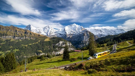
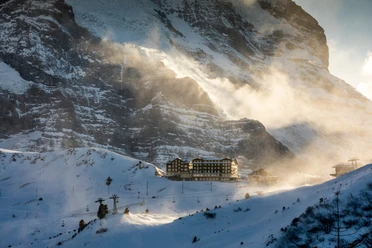
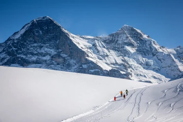
From the Grütschalp train station, the path initially ascends gently through forest, then continues almost level over the snowy meadows of Bletschenalp. The unique contrast is the deep view into the sharply U-shaped Lauterbrunnen Valley and the wide panorama of peaks enclosing the valley. The Schwarzmönch rises powerfully from the valley floor, behind which stands the Jungfrau majestically adorned by the two Silberhörner peaks. To the east of it lie Eiger and Mönch within reach, while to the west the crown of peaks continues with Äbeni Flue, Mittaghorn, Grosshorn and Breithorn. On the opposite valley side lies the winter sports resort Wengen and above it the Männlichen ridge. Wengen became world-famous through the Lauberhorn ski downhill run into the village, which can be seen almost in its entirety from here. After the alpine hut Im mittleren Prast, the path bends right and leads to Staubbachgraben. Of the torrents that in summer cascade abundantly down the Mürrenflue and once inspired Goethe’s poem “Gesang der Geister über den Wassern” (“Song of the Spirits over the Waters”), in winter only a meager trickle is apparent, if at all. The path continues through dark and shady forest to Winteregg. The route remains on the western side of the railway line here as well.
At the valley station of the chairlift bringing skiers and snowboarders to Maulerhubel (the place name refers to the sparkling wine with which wealthy winter sports fans once toasted on the slope), the path passes right by and then turns left just below the ski slope again heading towards the forest edge. Often directly alongside the railway line, then a little away from it again, the path leads through loose mountain forest, repeatedly revealing views of the magnificent mountain scenery. Soon you reach the mountain village Mürren, whose appearance is characterized on one side by bulky hotel buildings, and on the other by pretty wooden houses.

Good to know
Pavements
Best to visit
Directions
Equipment
Directions & Parking facilities
Outbound journey: By train from Bern via Interlaken to Lauterbrunnen. Then by train to Grütschalp.
Return journey: From Mürren by train back to Grütschalp and Lauterbrunnen.
Additional information
Literature
License (master data)
Safety guidelines
Map
Nearby
")