On an airy ridge over Lake Brienz


- 4:30 h
- 11.14 km
- 820 m
- 1,080 m
- 1,306 m
- 2,136 m
- 830 m
- Start: Lombachalp
- Destination: Harderkulm
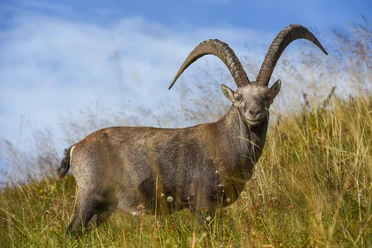
For a long time, the Augstmatthorn was considered the ultimate ibex paradise. But with the increasing number of hikers and wild campers, the ibexes have gradually retreated further away. However, the tour to the Augstmatthorn is an impressive experience even without wildlife observation. To ensure this remains the case in the future, we would like to point out the rules of conduct in the protected area around the Augstmatthorn: Stay on the paths, keep your dog on a leash, do not camp in the open, and take your rubbish with you. Furthermore, drone flights are forbidden.
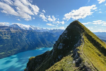
The starting point of the hike is the Lombachalp above Habkern, a moorland. The ground here is often muddy after rainfall – ideally, start after a longer dry period. The mountain trail climbs steeply, so you quickly gain altitude and approach the ridge. Once there, an impressive scenery opens up: the Bernese Alps rise before you, deep below glimmers Lake Brienz. Now it is not far to the highest point of the hike, the Augstmatthorn. The path is not entirely without challenges: Although the ridge is broad, not everyone feels comfortable here – so do not put yourself in danger and know your limits. Mountain experience and the right equipment are therefore a must.
From the Augstmatthorn, the path leads back along the ridge and further westwards. After the Suggiture, it steeply descends, requiring increased attention. About ten minutes after the turnoff to the Graaggetor and heading towards Ringgenberg, you reach a crossroads. To the right, a path leads towards Habkern or Lombachalp, the left path goes to the Balmhütte. The described route continues on course towards Harderkulm. Soon, you have to say goodbye to the spectacular view. On the side of the ridge facing Habkern, numerous roots make progressing on the path to the destination Harderkulm difficult, and some sections are often swampy.
Text: Karin Meier

Good to know
Pavements
- Path (98%)Trail (2%)
Best to visit
- suitableDepends on weather
Directions
- Lombachalp – Augstmatthorn – Suggiture – Roteflue – Harderkulm
Equipment
- We recommend the following equipment: sturdy hiking boots, medium-sized backpack with hip belt, sun protection, rainwear, hiking poles, first aid kit, picnic, plenty of fluids, mobile phone.
Directions & Parking facilities
- Public transportationArrival: by post bus to Habkern, Zäundli, further by alpine bus to Lombachalp (info at: busalpin.ch)
Return: by Harderbahn to Interlaken (please check the timetable), then on foot to Interlaken West station (10 min)
Additional information
- Bernese Hiking Trails, 031 340 01 01, info@beww.ch, bernerwanderwege.ch
License (master data)
Safety guidelines
- This route runs entirely or partly on marked trails of the mountain hiking trail category.
Map
- swisstopo hiking map: 254T Interlaken, 1 : 50,000