On a scenic altitude path


- 2:50 h
- 9.52 km
- 260 m
- 500 m
- 1,436 m
- 1,704 m
- 268 m
- Start: Grindelwald/Holzmatten
- Destination: Grindelwald/Im undren Loichbiel
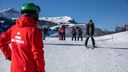
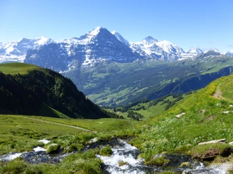
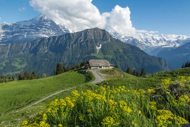
This varied hike with magnificent views begins at the Holzmatten bus stop. Refreshing is the change between forest, pastures, and hay meadows on the way to the alpine buildings Im späten Boden and Holewang (after Ällflüö–Grindelwald 1h). On an almost flat path, you bypass the pasture ridge descending from Furggenhorn, where the little road descends over the pastures Nodhalten and Räckholtertor to the Milibach stream. For the next section, two simultaneous variants are available on this side and the other side of the stream. However, the large viewing terrace at the Bort intermediate station of the First cable car (after Grindelwald 1h20) is tempting. Besides the magnificent view, soon the swampy-slate spots and the deeply cut course of the Bärgelbach stream at Wandela captivate, before reaching the bus stop Im undren Loichbiel at Scheideggstrasse.

Good to know
Pavements
Best to visit
Directions
Grindelwald/Holzmatten - Holewang - Nodhalten - Bort - Wandela - Grindelwald/Im undren Loichbiel
Equipment
We recommend the following equipment: lightweight trekking shoes, light backpack, sun protection, rain jacket, pocket first aid kit, light picnic, enough fluids, mobile phone.
Additional information
Association of Bernese Hiking Trails, Bern, Tel.: 031 340 01 01, E-Mail: info@beww.ch, Homepage: www.bernerwanderwege.ch
Literature
Hiking suggestion from the Jungfrau Region Brienzersee - Oberhasli hiking book, hiking book series of the Bernese Hiking Trails
License (master data)
Safety guidelines
This route runs entirely on hiking paths.
Map
Swisstopo hiking map 1:50,000 254T Interlaken
Nearby
")