Grimmifurggi – on familiar terms with nature


- 6:00 h
- 16.85 km
- 900 m
- 1,130 m
- 994 m
- 2,024 m
- 1,030 m
- Start: Schwenden/Grimmialp
- Destination: St. Stephan
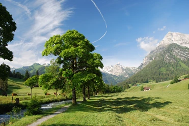
From the postbus terminus Grimmialp/Hotel Spillgerten, walk a few meters downhill on the road. At Egg, a narrow road with a considerable ascent leads over a mountain ridge up to Alp Nidegg. Already fascinated by the primitive mountain scenery: the bright rock pyramid of Seehore, the impressive walls of the Fromattgrat and the bulky summit of the Hindern Spillgerte. Along the further path to Alp Grimmi, shady spruce forests alternate with pasture, partly covered with green alders. After the alpine hut, the path descends slightly into a hollow. In late summer, the blue monkshood blooms here in large numbers. Terrain bumps, almost level areas and hollows alternate in the final climb to Grimmifurggi. The view from this grassy saddle is pretty: the flat ridge of the Albristhubel above the Färmeltal rises to Albristhorn. Further away rise Wildhorn, the mountains of the Geltental above Lauenen, and the Diablerets. Particularly impressive is the nearby southeast flank of the Spillgerte group. The descent is steep past Am obere Bluttlig to the huts Am undere Bluttlig (2h to Färmel/Stalde–Matten). Here, you keep horizontally through marshy terrain to the well-visible path that runs as an enjoyable high trail on the sunny side below the rock walls of the Spillgerte for more than 2 km downhill. Longer sections in the protective forest alternate with open avalanche zones. Crossing these, you enjoy delightful deep views into the Färmeltal. Rarely does a mountain valley have such a well-preserved settlement appearance. The avalanche danger often threatening here in winter months prevented the construction of non-local buildings. Maple groups, dark forests, lush mountain meadows, simple residential houses, barns, and alpine huts shape the character of the valley.
Almost level path reaches the scenic Dachbode. Magnificent view into the Wildstrubel-Wildhorn area. At Scharbenne, turn into the valley of the Zälgbach. After a flat section in the Gandbode forest, go steeply downhill on the left side of the brook into the valley floor. In Bifang noteworthy Simmental houses. In a few minutes, you reach the St. Stephan station.

Good to know
Pavements
Best to visit
Directions
Equipment
Directions & Parking facilities
Outbound: By train to Oey-Diemtigen. Then by bus to Grimmialp / Spilgerten.
Return: From St. Stephan by train to Zweisimmen.
Additional information
Literature
License (master data)
Safety guidelines
Map
Nearby


