From the Chaltenbrunnen raised bog to Rosenlaui


- 5:50 h
- 16.74 km
- 981 m
- 853 m
- 1,209 m
- 2,144 m
- 935 m
- Start: Chaltenbrunnen
- Destination: Rosenlaui
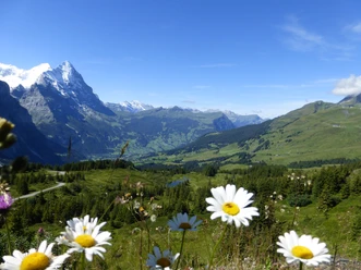
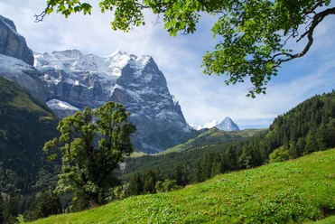
From the Chaltenbrunnen postbus stop briefly upstream into the valley, then across the Rychenbach and on a wide alpine path over pasture and through forest to the huts of Undere Stafel. Steadily ascending, you quickly gain altitude and reach the hut at Obere Stafel on the Chaltenbrunnenalp. The detour to the edge of the Chaltenbrunnen raised bog to point 1817 (30 min) is on the route to Wandelalp. The raised bog, covered with pines and Scotch pines, is a sight for every nature lover. Please be sure to use the same return route and follow the color markings above the Obere Stafel hut to ascend to the eastern rock base of the Tschingel. The view of the jagged rock teeth of the Engelhörner rising on the other side of the valley is magnificent: a climber's paradise, known well beyond the Swiss border. The path winds very steeply between rocks up to Chrüterenläger. After the hut, the magnificent high path begins over Grindelschärm (descent to Broch 1h45; to Gschwantenmad 1h40) to Grindelfeld. Along the edge of scree fields, the path now goes between rock ledges, partially without a path but without large altitude differences, crossing mountain streams, into the alpine hollow of Breitenboden, which rightfully carries its name. Ahead lie Wildgärst and Schwarzhorn, across the valley the furrowed walls of Wellhorn and Wetterhorn. At the huts in upper Breitenboden begins the descent along the Pfannibach to the valley floor of Schwarzwaldalp. In Broch, there are two almost simultaneous options for the return. The route past the Hotel Rosenlaui still allows for a visit to the impressive glacier gorge (circuit 45 min, entrance fee). Away from the road, it goes on a new hiking path past Gschwantenmad back to Chaltenbrunnen.

Good to know
Pavements
Best to visit
Directions
Equipment
Additional information
Literature
Hiking suggestion from the hiking book Bernese Oberland, hiking book series of the Bernese hiking trails
License (master data)
Safety guidelines
This route runs entirely or partially on marked paths of the mountain hiking trail category
Map
Swisstopo hiking map 1:50,000 254T Interlaken and 255T Susten Pass
Nearby

Download GPX file