Circular route to Pochtenfall


- 3:10 h
- 6.30 km
- 680 m
- 680 m
- 1,079 m
- 1,650 m
- 571 m
- Start: Suld
- Destination: Suld
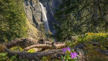
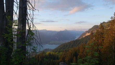
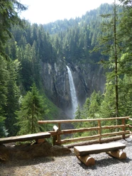
From Gasthaus Suld, after just 100 m on the path towards Louene, you have the choice of ascending on the left or right side of the Pochtenfall. The right and somewhat steeper variant takes you through the forest closer to the impressive Pochtenfall, which plunges about 80 meters down. At the Louene junction (P.1361), we turn towards Brunni and ascend over steep alpine meadows. Shortly before the Huetmad alpine hut, the path meets the hiking trail coming up from Schlieri. After the alpine hut, the ascent is complete; about 15 minutes later, the Brunnihut is reached. Those wishing to rest can do so either directly at the hut or, even better, proceed a few meters to the grassy summit P.1660 of Brunnigrind. Here one has a wonderful view over Lake Thun.
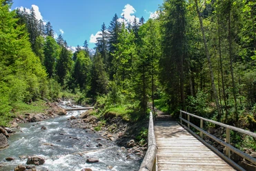
From the Brunnihut, we follow the signposting descending towards Greberegg and hike over a beautiful ridge section overlooking Lake Thun. At the Greberegg junction we turn left towards Suld; after 200 m the Greberegg alpine hut is reached. From here you see the Brunnihut with the towering Morgenberghorn above it; the Schwalmere looms over the valley end, and to the right the First and the Dreispitz. We descend to the left and reach Gasthaus Suld via a steep and beautiful forest path.

Good to know
Pavements
Best to visit
Equipment
Directions & Parking facilities
Arrival: by bus from Spiez train station via Aeschiried to Gasthaus Suld
Return journey: by bus from Gasthaus Suld via Aeschiried to Spiez train station
Additional information
Literature
Hiking book Bernese Oberland by the Bernese hiking trails.
License (master data)
Safety guidelines
Map
Swisstopo hiking map 254T Interlaken 1:50,000
Nearby

Download GPX file