Arctic island in the Bernese Oberland

- 1:15 h
- 3.85 km
- 115 m
- 112 m
- 1,592 m
- 1,702 m
- 110 m
- Start: Kandersteg/Oeschinen
- Destination: Kandersteg/Oeschinen
The Kandersteg–Oeschinensee chairlift is rightly considered nostalgic: the individual chairs hang crosswise to the direction of travel on the cable, offering passengers a cinema-like landscape experience: like in a film, the mountain world slowly passes by, unobstructed by any masts or station buildings.
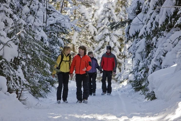
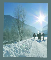
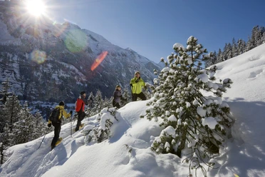
The Oeschinen mountain station is located on a sunny terrace high above the Kandertal valley and its steep side valleys. The winter hiking trail towards Oeschinensee initially leads without significant elevation changes through the ski area, crossing slopes and ski lift routes. The terrain is clear and not very steep; however, care and attention are advised when crossing. After passing the second ski lift, you reach the snowy and sparsely wooded alpine meadow settlement of Läger. Already, between the trees, the wide ice surface of the frozen Oeschinensee can be seen. The path now descends in broad switchbacks towards the lake. In mid-winter, the high peaks of the Blüemlisalp in the east as well as of Fründenhorn and Doldenhorn in the south ensure that hardly a sunbeam reaches the valley basin. The Oeschinensee is therefore somewhat like a piece of the Arctic in the Bernese Oberland. A powerful ice layer covers the lake surface. Provided there has been a sufficiently long preceding cold period, the ice can usually be walked on safely. Cross-country skiers leave their tracks across the lake, and ice fishermen lower their lines through holes they have drilled in the ice into the icy water. From the group of houses at the western end of the lake, a 10-minute detour along the northern shore leads to a special winter natural spectacle: even in freezing temperatures, a small stream cascades over the rock wall there. At the base, the water immediately freezes, forming an ice tower that can grow several meters high during the winter.
The return route to the Oeschinensee location is either along the same path or across the frozen lake. From there, you ascend gently through a fir forest back to the Oeschinensee ski area and the Oeschinen chairlift mountain station. Return to the valley is either by the chairlift again or via a speedy sled run. (Those deciding at short notice can rent a sledge at the sports shop opposite the chairlift mountain station.)

Good to know
Pavements
Best to visit
Directions
Equipment
We recommend the following equipment: sturdy and waterproof hiking boots, a light to medium backpack, cold protection, sun protection, hiking poles, small first aid kit, snacks, tea in a thermos flask, mobile phone.
Directions & Parking facilities
By train from Bern to Kandersteg. Then a walk to the valley station Oeschinen. Ride to the mountain station Oeschinen.
Additional information
Literature
License (master data)
Safety guidelines
Nearby
Download GPX file